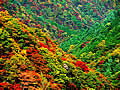
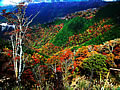
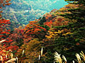
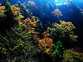
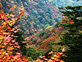
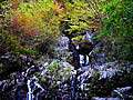
Koya Ryujin skyline
It is a wallpaper photograph of the Koya Ryujin skyline at the time of autumnal leaves.
|
The Koya Ryujin skyline is a mountains road of 42.7km [ which connects Ryujim-mura, Hidaka-gun (present Tanabe) to Ito-gun, Wakayama Koyasan-cho / in full length ] whole-line 2 lane width.
Although it was a toll road before, it is the general national highway No. 371 line now, and is a mountains road which can enjoy wonderful scenery centering on Gomadan-zan. In along the altitude Gomadan-zan circumference part of 1372m of the time of autumnal leaves, or a route, wonderful autumnal leaves can watch here and there especially. The best-time-to-see time of the autumnal leaves of the Koya Ryujin skyline is at the end [ of October ] - the beginning time of November every year.
|
Autumnal-leaves drive |
About the Koya Ryujin skyline |
Skyline Free opening |
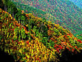
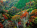
The autumnal leaves of the Koya Ryujin skyline |
The feature of autumnal leaves |
Autumnal leaves of a skyline Best time to see |
The way to the Koya Ryujin skyline |
Photography spot |

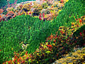
Japanese pampas grass and autumnal leaves |
The middle of going down to the Ryujin side |
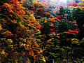
Light and a shadow |
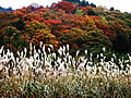
The field and autumnal leaves of Japanese pampas grass |
The middle of going to Ryujim-mura |
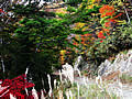
Autumnal leaves and Kotaki |
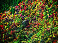
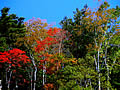
Various autumnal leaves |
Tsuruhime park observatory |